By Patrick Whittle and Brian Witte Associated Press arctic air heavy snowfall
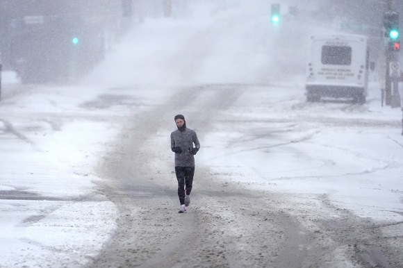
A blast of snow, ice, wind and plunging temperatures stirred up dangerous travel conditions in parts of the central U.S. on Sunday, as a disruptive winter storm brought the possibility of the “heaviest snowfall in a decade” to some areas.
Snow and ice blanketed major roadways in nearly all of Kansas, western Nebraska and parts of Indiana, where the state’s National Guard was activated to help any motorists who were stuck. At least 8 inches of snow were expected, particularly north of Interstate 70, as the National Weather Service issued winter storm warnings for Kansas and Missouri, where blizzard conditions brought wind gusts of up to 45 miles per hour (72.42 kilometres per hour). The warning extended to New Jersey for Monday and into early Tuesday.
“For locations in this region that receive the highest snow totals, it may be the heaviest snowfall in at least a decade,” the weather service said early Sunday.
About 63 million people in the U.S. were under some kind of winter weather advisory, watch or warning on Sunday, according to Bob Oravec with the National Weather Service.
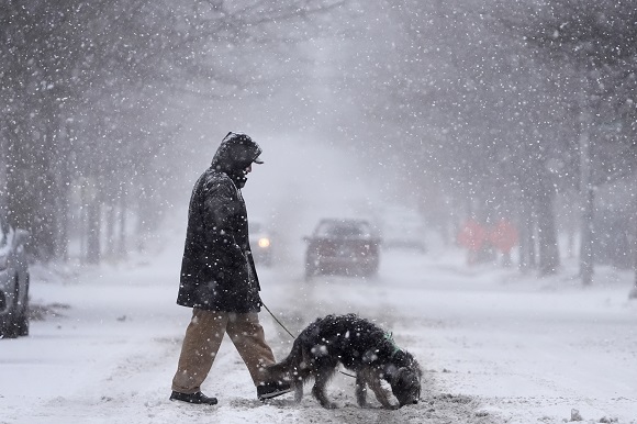
Gary Wright wore a parka as he chipped away at a thick coating of ice on his SUV Sunday in a slippery apartment parking lot in mid-Missouri. He said he will work remotely for the University of Missouri-Columbia on Monday, but wanted to scrape off his vehicle as an excuse to spend a little time in the snow. He’s also in the market for boots for his two older dogs, who “won’t budge at all” when their paws hit the cold ground.
arctic air heavy snowfall
The polar vortex of ultra-cold air usually spins around the North Pole. People in the U.S., Europe and Asia experience its intense cold when the vortex escapes and stretches south.
Studies show a fast-warming Arctic is partly to blame for the increasing frequency of the polar vortex extending its icy grip.
Snow and ice in the forecast, and even possible tornadoes
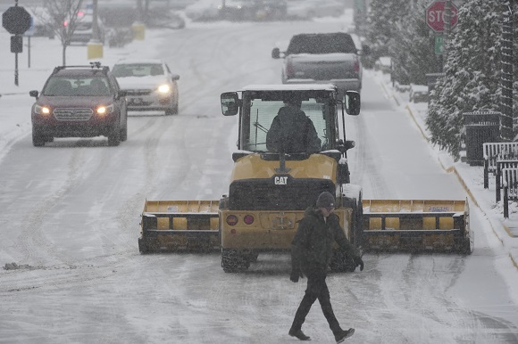
In Indiana, snow fully covered portions of Interstate 64, Interstate 69 and U.S. Route 41, prompting Indiana State Police to plead with motorists to stay off the roads as plows worked to keep up with the pace of the precipitation.

“It’s snowing so hard, the snow plows go through and then within a half hour the roadways are completely covered again,” Sgt. Todd Ringle said.
A section of I-70 was closed in central Kansas by Saturday afternoon. Roughly 10 inches (25 centimeters) of snow had fallen in parts of the state, with snow and sleet totals predicted to top 14 inches for parts of Kansas and northern Missouri.
In Kentucky, Louisville recorded 7.7 inches (19.5 cm) of snow on Sunday, a new record for the date that shattered the previous mark of 3 inches (7.6 cm) set in 1910. Lexington, Kentucky, also set a snowfall record, with 5 inches (12.7 cm).
Parts of upstate New York saw 3 feet (0.9 meters) or more of snow from a lake effect event expected to last until late Sunday afternoon.
The storm was forecast to move into the Ohio Valley and reach the Mid-Atlantic states later Sunday and into Monday, with a hard freeze expected as far south as Florida.
Damaging winds brought down trees across the Deep South. The weather service issued tornado warnings Sunday in Arkansas, Louisiana and Mississippi.
Car wrecks proliferate as storm hits
The weather service warned that road travel could be “very difficult to impossible.”
By Sunday, hundreds of car accidents had been reported in Virginia, Indiana, Kansas and Kentucky, where a state trooper was treated for non-life-threatening injuries after his patrol car was hit on Interstate 65. At least 600 motorists were stranded in Missouri, that state’s highway patrol said.

Highways in northeastern Kansas were closed due to “impassable” conditions, according to the state’s Transportation Department. The closures included roughly 220 miles (354 kilometers) of the state’s main artery, Interstate 70, from the Missouri border into central Kansas.
Kentucky Gov. Andy Beshear, who declared a state emergency ahead of the storm, said state buildings would be closed Monday.
“We see far too many wrecks out there for people that do not have to be on the roads, so I want to ask: Stay inside. Stay safe with your family,” the governor said.
Virginia State Police reported at least 135 crashes as the storm entered the state Sunday. A handful of injuries were reported, but no fatalities.
Air and rail travel also snarled
The storms also caused havoc for the nation’s railways, leading to numerous cancelations. More than 20 cancelations were planned on Sunday, 40 for Monday and at least two for Tuesday.
“If local authorities are telling people not to travel, it’s counterintuitive to try to run a full slate of services when people are being told to stay home,” Amtrak spokesperson Marc Magliari said.
The Midwest was hit especially hard. A train between Chicago and New York and several regional trains between Chicago and St. Louis were among those canceled Sunday.
Nearly 200 flights in and out of St. Louis Lambert International Airport were canceled, according to tracking platform FlightAware.
Temperatures dip, though no records break
Starting Monday, the eastern two-thirds of the country will experience dangerous, bone-chilling cold and wind chills, forecasters said. Temperatures could be 12 to 25 degrees (7 to 14 degrees Celsius) below normal.
In Chicago on Sunday, temperatures hovered in the teens (minus 7 to 10 Celsius) and around zero in Minneapolis, while dropping to 11 below in International Falls, Minnesota, on the Canadian border.
The Northeastern states are more likely to experience several days of cold following what has mostly been a mild start to winter, said Jon Palmer, a meteorologist with the National Weather Service in Gray, Maine. A plume of cold air coming down from Canada is likely to result in a cold but dry week, he said.
The cold air will likely grip the eastern half of the country as far south as Georgia, Palmer said, with parts of the East Coast experiencing freezing temperatures and lows dipping into the single digits in some areas.

Wind might also pick up as the week gets going, making for potentially dangerous conditions for people exposed to the elements for long periods of time, Palmer said.
Disruptions extend southward
The National Weather Service predicted 8 to 12 inches (about 20 to 30 centimeters) of snow for the Annapolis, Maryland, area, with temperatures remaining below freezing throughout the weekend.
In a statement on X, Virginia Gov. Glenn Youngkin declared a state of emergency Friday ahead of the storm and encouraged residents to vote before the state’s special elections on Tuesday.
Similar declarations were issued in Kansas, Kentucky, Maryland, West Virginia and in central Illinois cities.
Classes canceled
School closings were likely to be widespread Monday. Districts in Indiana, Maryland, Virginia and Kentucky were already announcing cancelations and delays on Sunday afternoon.
Kentucky’s Jefferson County Public Schools canceled classes, extracurricular activities and athletics Monday for its nearly 100,000 students. The day would have been students’ first one back after winter break.
“This is a traditional snow day with no online learning,” the district announced.
Read more of AP’s climate coverage at http://www.apnews.com/climate-and-environment
Witte reported from Annapolis, Maryland and Whittle from Portland, Maine. Contributing were Associated Press journalists Julie Walker in New York; Sophia Tareen in Chicago; Christopher Weber in Los Angeles; Kimberly Chandler in Montgomery, Alabama; and Summer Ballentine in Columbia, Missouri.


